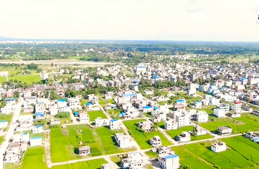
Urlabari municipality, located in the northeast region of Morang district, about 55 km from Biratnagar, was declared as a municipality according to the decision of the Government of Nepal dated 2071.01.25 and then according to the decision of the government of Nepal dated 2073.11.27, Urlabari municipality was transformed into Savik Rajghat Ga.V.S and Savik. Madhumalla Ga.V.S. Wards 7, 8, and 9 have been adjusted and implemented as Urlabari Municipality.
The borders of Urlabari are defined as follows: to the east lies Damak Municipality, to the west are Pathari Sanischare Municipality and Letang Municipality, to the north is Miklajung Village Development, and to the west is Rayuwa Mai Municipality.
Urlabari is home to several community forests, including Srijana Community Forest, Sunjhoda Community Forest, Salbari Community Forest, and Beteni Community Forest.
In terms of educational institutions, Urlabari boasts over ten government-run schools, such as Urlabari Bahumukhi Campus, Radhika Higher Secondary School, Sunpakkwa Higher Secondary School, Radhika Secondary School, Srijana Secondary School, Durga Secondary School, and Sunjodha Higher Secondary School, among others.
Additionally, there are more than 15 privately operated secondary and higher secondary schools in the area.
This municipality, which is aiming to be known as a model city in Morang district, is bordered by Damak municipality of Jhapa district in the east, Patharishanishchare municipality and Letang municipality in the west, Miklajung village municipality in the north and Ratuwamai municipality in the south.
The area of this municipality is 74.62 square km. has been This municipality is located at 26.67 degrees north latitude and 87.61 degrees east longitude from sea level. In this city, there are 13,761 households with 51.13 percent women and 48.87 percent men out of a population of about 70,605. Although most of the land is arable land, the increasing urbanization has made it necessary to plan and work systematically in the development of this area.
How do you spell Urlabari? The two words of Santhal language are urla (tiger) and wadi (place) or the old forest area known as the place where the tiger lives can be considered to have gradually developed into an urban area with the increase in human settlement.
Even though there is a road from Urlabari Chowk to Ravi in Panchthar through North Madhumalla and an alternative road leading directly to the headquarters in the south, its development potential can be seen in abundance. With Betini Wetlands, Budha Thakur, Lampate Wetlands and the efforts made at the municipal and local levels to promote them, Urlabari municipality seems to have more potential in tourism development.
What is the elevation of Urlabari?
Urlabari Municipality is situated in the Terai region of Nepal. Its elevation ranges from approximately 116 to 164 meters above sea level. The majority of the town is located on flat terrain.

